Spring Trail Closures
PLEASE RESPECT TRAIL CLOSURES!
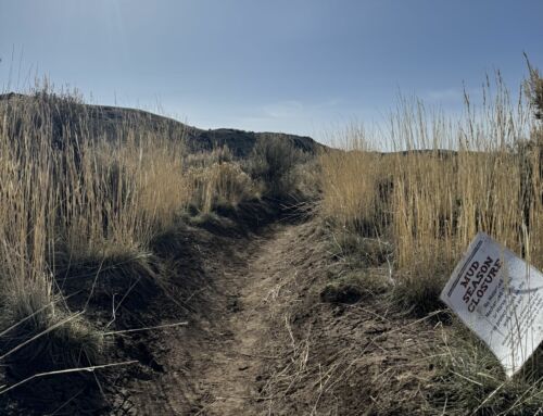
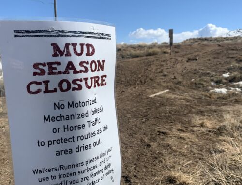
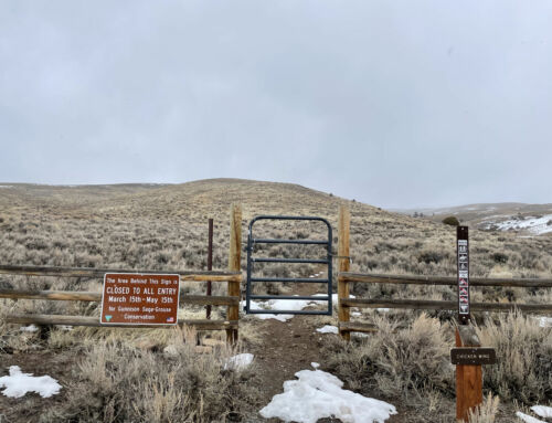
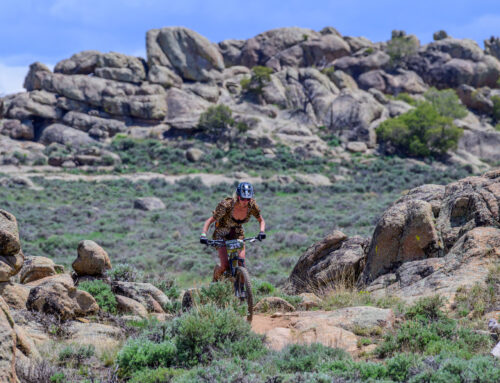
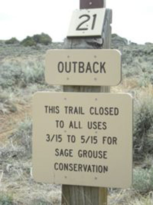
Springtime is one of the most critical times for wildlife in the Gunnison basin. There are several road, trail and area closures that go into effect March 15th, including a new area closure in the Signal Peak Area. There are closures for the Gunnison Sage grouse (typically any closure from March 15 – May 15), closures to protect wintering elk and mule deer (Jan. 1 – April 30th in Signal Peak), and mud closures on roads and trails throughout the County to protect both Sage grouse and prevent road damage during the wet spring conditions. Needless to say, things can get a bit confusing out there this time of year. To simplify, here’s a list of closures by area:
HARTMAN ROCKS:
- All roads and trails SOUTH of Powerline Rd. (Bambi’s, Sawtooth, Back-In, 9-0, Outback, Skull Pass and Aberdeen Loop) closed to motorized and mountain bike use from March 15 – May 15 for Sage grouse conservation.
SIGNAL PEAK:
- The northwest portion of the Signal Peak area will be closed to ALL USES (snowshoers, skiers, dog walkers, hikers, bikers) from MARCH 15 – MAY 15 for Sage grouse conservation. This includes the Ridgeline trail from the second radio tower, Rasta Gulch, Chicken Wing, Cranor Hill and Shoelace trails. Check out our Signal Map to see all closures for the area.
- The entire Signal Peak area is closed to bikes from January 1 – April 30, and no use before 10am May 1 – May 15
- The entire Signal Peak area is closed to motorized use from January 1 – May 15
- For hikers, no use prior to 10am March 15 – May 15
- The Campus Trails behind Western Colorado University are not subject to the area closures for Signal Peak (as they are not managed by the BLM) and are a great early season outlet as trails begin to dry out. Trails include the Canal trail, the Contour Connector, the western portion of the Contour trail, Old Car, Zig Zag, the Exercise trails and the Flow Track. See map in the sidebar for those trails open early season.

